< Longwave Lows | Guide to Baroclinic Disturbances | Alberta Clippers >
U N D E R C O N S T R U C T I O N
Common Storm Tracks of Midlatitude Cyclones
Border Trackers
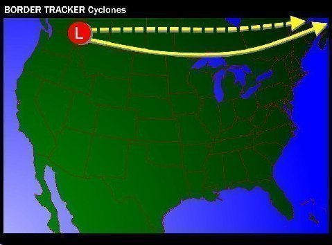
Region Of Cyclogenesis: British Columbia
Lowest Range Of Central Pressure At Surface: 988 to 1000MB
Forward Speed: Rapid; coast to coast sequence within 72 hours
Season of Occurrence: Any
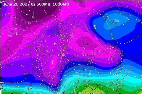
500MB Structure: Shortwave or Hybrid; transitional from semizonal to amplifying trough; one of the most common types of storm track
Associated Sensible Weather: High winds along and north of 40°N latitude; very strong warm advection along and south of storm track; precipitation usually sparse within the warm sector, except in cases during the “January Thaw”; Border Tracker storms in mid-January may draw in deep tropical moisture from the Gulf of Mexico, resulting in widespread overrunning and convective rainfall along and to the right of the trajectory of lowest surface pressure falls. Locales close to the actual storm track may see mixed or icing precipitation, with snowfall relegated to Canadian communities affected by the disturbance. Storms of this track type can be prolific severe thunderstorm producers in southern Canada and the northern Great Plains during the summer months.
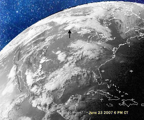
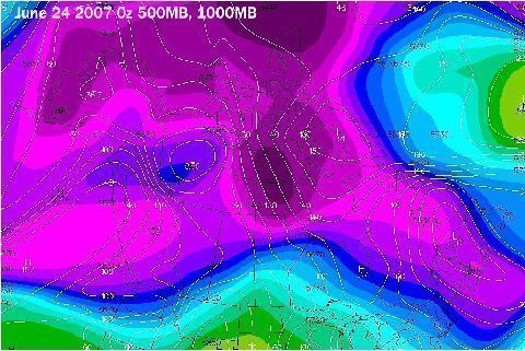
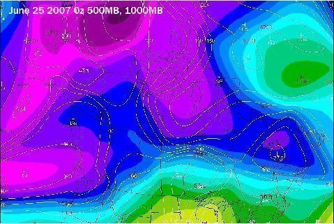
Classic Case: The severe weather outbreak of June 22 - 25 2007 across the Prairie Provinces and Ontario (see footage of EF 5 cell at Elie MB June 23 2007 here) was in relation to a northern variant of a Border Tracker cyclone.
"A Guide to Baroclinic Disturbances" is © 2007 by Larry Cosgrove.
All rights reserved.

|  IN-AL-99 |


